Mapping the Battle of the Little Bighorn
21 September 2018
We are going to try re-create the Battle of the Little Bighorn, known to the Lakota and other Plains Indians as the Battle of the Greasy Grass. It is also commonly referred to as Custer's Last Stand.
We are going to play this recreation across three maps, even though we know this is ambitious for a participation game. They are a Renos battel map, Renos Hill map and Custer’s Hill map. The last on is thought to be where the last stand took place.
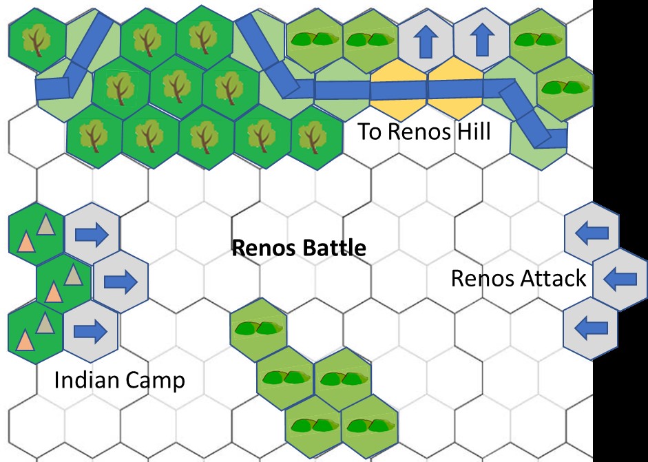
Map One - Reno's Battle Map
 This map covers the initial attack and subsequent retreat of Major Reno’s battalion.
It also covers the Indian response to this surprise attack. Which went from left to right across the photo
The map is 900mm x 1000mm (9 hexes x 10 hexes) it features the following:
- The Little bighorn River
- Woods
- Hills
- Village Edge
- Entry and Exit points
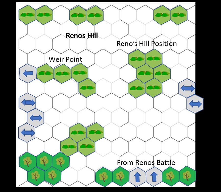
Map Two - Reno's Hill
 This map covers the end of the Reno's battalions flight, the arrival of Benteen's battalion, the defense of Reno’s Hill and the arrival of McDougall’s battalion and the Pack Train.
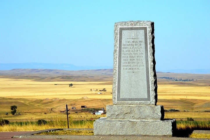
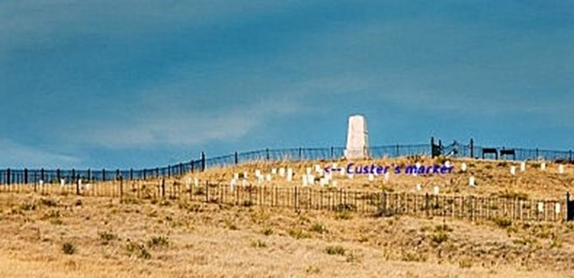
This also covers the continued Indian attacks on the Reno hill position. The monument is at the point known as Reno Hill, site of the Reno/Benteen entrenchments.
The map is 1200mm x 1000mm (12 hexes x 10 hexes) and it features:
- Woods
- Hills
- Entry and Exit points
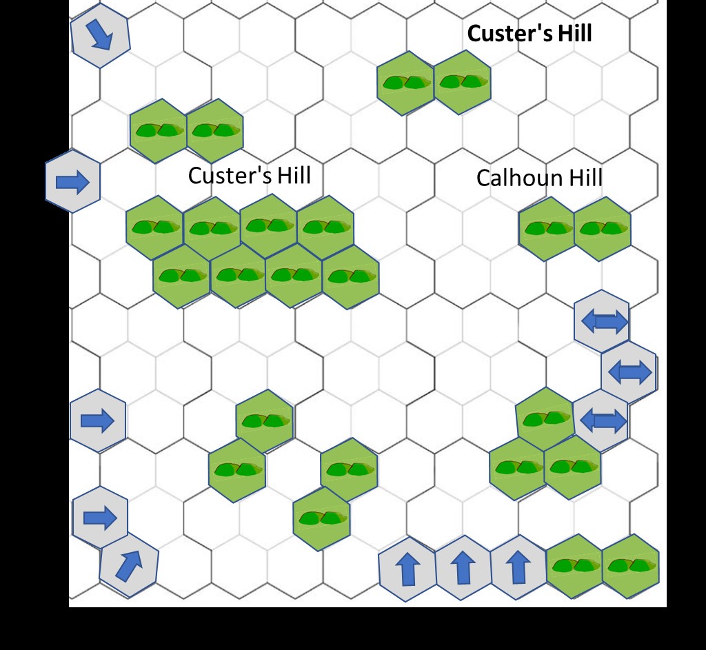
Map Three – Custer’s Hill
 This map covers from Custer’s arrival to the defeat of Custer’s command.
This part of the battle ends with Custer’s battalion's destruction or victory.
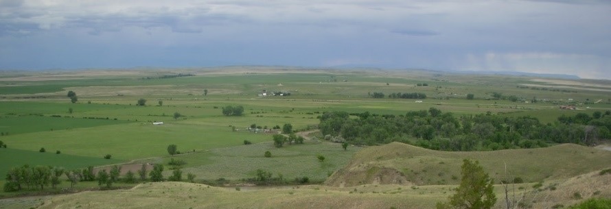
Last Stand Hill at the Little Bighorn from the trail down to the Deep Ravine.
The map is 1200mm x 1000mm (12 hexes x 10 hexes) it features:
- Custer’s Hill
- Calhoun Hill
- Woods
- Village Edge
- Entry and Exit points